Værmelding for Garland Park
Advarsler
Winter Storm Watch issued February 15 at 1:19PM MST until February 18 at 9:00AM MST by NWS Missoula MT* WHAT...For the Winter Weather Advisory, snow expected. Likelihoodof moderate impacts from 2 to 5 inches of snow is greater than 90percent. For the Winter Storm Watch, heavy snow possible. Chanceof moderate to major impacts from wind and snow is at least 50percent, mainly in the Missoula Valley. Total snow accumulationsbetween 6 and 10 inches possible.* WHERE...Bitterroot Valley and Missoula.* WHEN...For the Winter Weather Advisory, from 2 AM Sunday to 2 PMMST Monday. For the Winter Storm Watch, from Monday afternoonthrough Tuesday morning.* IMPACTS...For MODERATE impacts from snow, expect disruptions tonormal activities. Hazardous traveling conditions. Use extracaution while driving. Closures and disruptions to infrastructuremay occur. For MAJOR impacts from snow, expect considerabledisruptions to normal activities. Dangerous or impossibletraveling conditions. Avoid travel in the impacted areas ifpossible. Widespread closures and disruptions to infrastructuremay occur. The hazardous conditions could impact the Mondaymorning and evening commutes, especially over higher passes.Slow down and use caution while traveling. The latest roadconditions for the state you are calling from can be obtained bycalling 5 1 1.Monitor the latest forecasts for updates on this situation.
National Weather Service
Winter Weather Advisory issued February 15 at 1:19PM MST until February 17 at 2:00PM MST by NWS Missoula MT* WHAT...For the Winter Weather Advisory, snow expected. Likelihoodof moderate impacts from 2 to 5 inches of snow is greater than 90percent. For the Winter Storm Watch, heavy snow possible. Chanceof moderate to major impacts from wind and snow is at least 50percent, mainly in the Missoula Valley. Total snow accumulationsbetween 6 and 10 inches possible.* WHERE...Bitterroot Valley and Missoula.* WHEN...For the Winter Weather Advisory, from 2 AM Sunday to 2 PMMST Monday. For the Winter Storm Watch, from Monday afternoonthrough Tuesday morning.* IMPACTS...For MODERATE impacts from snow, expect disruptions tonormal activities. Hazardous traveling conditions. Use extracaution while driving. Closures and disruptions to infrastructuremay occur. For MAJOR impacts from snow, expect considerabledisruptions to normal activities. Dangerous or impossibletraveling conditions. Avoid travel in the impacted areas ifpossible. Widespread closures and disruptions to infrastructuremay occur. The hazardous conditions could impact the Mondaymorning and evening commutes, especially over higher passes.Slow down and use caution while traveling. The latest roadconditions for the state you are calling from can be obtained bycalling 5 1 1.Monitor the latest forecasts for updates on this situation.
National Weather Service
Værmelding for Garland Park

24 °F
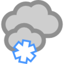
Overskyet og lett snø
Føles som
Lufttrykk
Duggpunkt
Luftfuktighet
Sikt
Soloppgang
Solnedgang
Daglengde
Per
25°
30.1 tomme
23°
93%
1.2 mi
07:39
18:02
10 h 23 min
16/02 6:41 am
Observert ved